Thursday, December 30, 2010

Nénuphars de Glace (Ice Water Lilies)

A week ago Paulette, Michelle and I snowshoed from the Centre Le Refuge-St-Adolphe-Stoneham down along the Rivière des Hurons. In the picture below you can see a waterfall (les trois chutes) cascading into a open pool of water in the foreground. Pretty, yes?

A week later (December 27) we returned with Fiona and Pete, family friends and snowshoe neophytes, to see the same waterfall, this time with the most amazing ice water lilies bobbing/undulating at its foot. What caused them to form? Why are they circular? Why the different sizes? Happily I don't need answers to appreciate their beauty.

Check out Morten Prom's flickr page to see Oslo Fjord ice lilies.

Canon 7D, 15-85 mm lens at 15 mm, 1/160 sec, f/8, ISO 320

Monday, December 20, 2010

Snow Day Challenge - PHOTONews

I've been going through my collection of winter photos (the number of winter photos I have testifies to the length of this season and the amount of time I spend outdoors) and submitting the best to a PHOTO News "Snow Day Challenge". They're looking for "subjects that represents friends or family enjoying winter activities - or any image that you feel is really "cool" in every sense of the word!"

Follow Snow Day Challenge link to see who's posting what at PHOTO News or go to my flickr page the see my Snow Day choices.

Happy Holidays.
More photos to come in 2011.
Andrew

Tuesday, December 7, 2010

Four-Bridge Walk

When we only have an hour and no time to drive to the many trails around Quebec City our default walk is along the Rivière Cap-Rouge. Even late in the afternoon near sunset (4 pm currently and still getting earlier), we complete our 5 km, Four-Bridge Walk in just under an hour. If I'm stopping to take pictures we need a little more clothing and a little more time.

In the photo above Paulette is pointing the way across snow-laden Bridge #2. I'm shooting with a 70-200 mm lens at f/4 and ISO 800 so digital noise is a problem when you look at the image full size. The same is true for the reindeer-on-rooftop near Bridge #4 taken ten minutes after sunset.

Christmas light are a welcome sight in December, dispelling the gloom of shortened days.


Saturday, November 20, 2010

First Snow

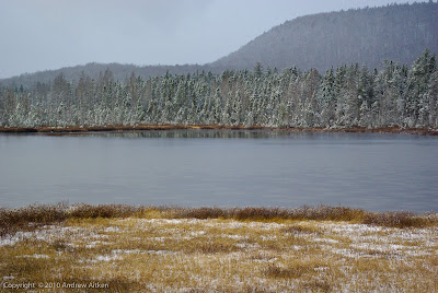
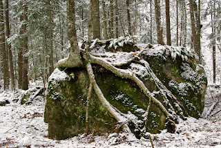
Paulette and I have been walking in snow for the last two weeks at higher elevations in Charlevoix and Mont Mégantic; however, today we woke up to a delicate layer of snow in our backyard. With warm weather predicted later this week it is unlikely to stay. But we are happy to see a brightness in the landscape that dispels the November gloom. Snowshoeing here we come!

These pictures were taken last year during a walk in Station touristique Duchesnay on November 30, the first snow day of 2009.

Saturday, November 13, 2010

Golden Reflection

Thursday past (Nov 11) Paulette, I and the TamaLOUPs hiked the Mestashibo trail along the Rivière Sainte-Anne. After lunch we reached the Cathedral, a narrow twisting gorge with fast moving water. While the river was in shade, reflected sunshine produced this rich monochromatic golden sheen. Lovely! Check back to the post Water on Ice to see a touch of gold.

Canon 7D at 35mm, ISO 200, 1/20 sec (slow shutter speed to create movement blur in the rapids), f/13 (for increased depth of field)

A few days earlier (Nov 6) Paulette, I and our friend Denis hiked to the top of Mont Saint-Joseph (elevation 1000m) in the Parc national du Mont-Mégantic where snow and hoar frost created the winter scene below. Interesting how an elevation change moves the seasons back and forward.

Canon 7D at 27mm, ISO 320, 1/640 sec, f/11

Wednesday, November 10, 2010

Charlevoix

November 7th we returned to standard time. Consequently our afternoon light disappears an hour early (sunset is just after 4 pm in Quebec City)! Ugh (definition - used to express disgust or horror - synonym is yuck or yecch)

However our late October walking in Charlevoix was marvelous (definition - wonderful, astonishing - antonym - rotten or Ugh). The sun shone and winds ranged from gale-force to calm. Temperature was near zero but very comfortable for climbing Mont du Lac-des-Cygnes, La Chouenne and Mont du Dôme.

In the large photo I'm shooting north as we climbed the tourist path up Mont du Lac-des-Cygnes. Picture center is Mont du Dôme that we tackled the next day and found more rugged with a scenic outlook to the south where you see Paulette, Karen and Lorne picnicking below.

Canon 7D at 22mm focal length, ISO 320, 1/1000 sec, f/ 10 ( I kept a fast shutter speed to freeze the walking action of my subjects. It wasn't necessary for shots of mountains that move very slowly even in Charlevoix)

Go to flickr to see a small Charlevoix album.

Thursday, November 4, 2010

Cap Tourmente, Québec

November, dark and damp, is upon us. This picture from Cap Tourmente helps me hang on to the warm colours and temperatures of October.

Two times annually (and more) Paulette and I drive an hour downriver (NE compass bearing) to this Federal natural wildlife area where we commune with the snow geese ( Chen caerulescens atlantica ).

Their fall migration begins in September after breeding on Baffin Island and passes directly over Cap Tourmente where they feed (primarily on the rhizomes, or roots, of bulrushes) for three weeks in October before continuing south to their winter range along the Atlantic seaboard of the southern USA. The photo below shows a small sample of the 40,000 geese in the area on October 17.

A myriad of ducks, great blue herons and peregrine falcons feed in-and-about this small marsh (Marais de la Petite-Ferme) shown above.

Canon 7D with 70-200mm lens, focal length: 109 mm, ISO 640, 1/200sec (a little slow for hand holding a non-stabilized lens), f / 5.6. Taken at 4:30 pm


Monday, November 1, 2010

Autumn Leaves Leave

By 3:45 pm on October 18 the sun was low in the sky. Paulette and Carole walked ahead of me as we returned from a brisk loop in the Parc naturel du mont Bélair. I asked them to advance slowly into the backlit scene as I adjusted my camera settings and composed this shot.

I love the red maple leaves carpeting the path and the transition from shadow in the foreground to the bright highlights in the background.

Taken in RAW I developed it using Lightroom 3: light cropping and straightening; lowered exposure, medium contrast curve; increased vibrance to highlight the reds; a little output sharpening and voila!

Canon 7D, 15-85 mm lens at 46 mm, ISO 200, 1/100 sec, f/5.6

Tuesday, October 19, 2010

Autumn Leaves

October 14, our walking group was heading north from the small rural town of Saint-Ubalde towards Rémi's chalet on Lac Émeraude. The weather was hovering between light rain and sunny passages. This gravel road undulates along the lake's north shore. The red leaves on the roadside and the warm tones in the middle distance invite you to walk up the next rise.

Canon 7D with 15-85 mm zoom: 1/60 s, f/7.1, ISO 400, focal length 24 mm

Friday, October 8, 2010

Acadia National Park

Acadia National Park shares Mount Desert Island with a number of fishing villages including Bar Harbor. Samuel de Champlain named this mountainous landscape Isle des Monts Deserts in 1604. In 1919 it became the first national park east of the Mississippi River. Today it's one of the top ten most popular US national parks with three million visitors a year.

Paulette and I stayed in a rustic cabin not far from the park entrance. We did the touristy things: window shopping in bustling Bar Harbor; eating clam chowder one night and succulent lobster the next; watching the to-and-fro of harbour traffic.

We also hiked on two consecutive days
  • Day One First we walked along the Ocean Trail in gentle rain, past the very popular Thunder Hole then up to the summit of Gorham Mountain before lunch at The Bowl (the lake in the photo). More gentle climbing along a pink granite ridge took us to Champlain Mtn (1058 feet). Squat, gnarled pitch pines grow in the very thin soil and right up to the summit. The odd sugar maple and low-growing bushes glowed red in the sun.
  • Day Two In early morning sunshine we started off from the Sieur de Monts Entrance. It was level walking past The Tarn, then steeply up the granite stairs of the Ladder Trail. Schiff Trail took us more gently to the top of Dorr Mtn (1270 feet). We unlaced our boots and rested while our socks dried. Using our poles we carefully picked our way down a steep ravine and back up the other side to Cadillac Mtn (1530 feet). Cadillac Mtn, a short drive from the Park Loop Road, is a favourite spot to view the sunrise and gives wonderful panoramic views of Bar Harbor and the many island dotting the Maine coast. Paulette and I ate our lunch on a warm rock away from the crowds. In shorts and T-shirt we ambled back down to the loop road following the North Ridge Trail.
We debated staying for a third day but, with rain in the forecast, we packed up and headed north towards home. There are many more hikes in this area so we will surely be back.


Thursday, September 30, 2010

Kéno-marche 2010

For the last five years, we and a large group of supporters have raised funds for La Fondation Kéno (site en français) by walking along a beautiful green bicycle path between the small town of Saint-Raymond (50 km north-west of Quebec City) and a road stop along Route 367, 18.6 km east.

The fall colours in this region are dependably spectacular at the end of September. This year, for the first time, we walked part of the way in the rain. The rain heightened our appreciation of the dry interludes, lowered the light's contrast and supersaturated the warm hues. I particularly liked these muted, lacey ferns that bordered the path in many areas.

Click the link for more pictures of our very successful Kéno-marche day.


Tuesday, September 21, 2010

La Traversée de Charlevoix


Late last October Paulette and I spent three days exploring several trails in the Pied-des-Monts sector of La Traversée de Charlevoix. We were invited by Jacques Breton and a group of friends to stay at La Marmotte, a chalet located at the end of Day 2 along the 105 km Traversée.

A Canadian Geograhic journalist, Dan Rubinstein, was in the area and wrote an article on his solo trek. He illustrated his piece using Jacques Breton's and my photos. Read his story entitled, Hiking La Traversée de Charlevoix.

The picture above is Refuge Boudreault under a delicate dusting of snow; one of the more rustic camps along the trail less than a kilometer from La Marmotte.

Friday, September 10, 2010

Parc naturel du mont Bélair


Fall colours seem to appear first in the forest under-story. Paulette and I walked in the Parc naturel du mont Bélair yesterday, a mere 13 km directly north from our home.

It was cloudy-bright in the open and cloudy-dim in the forest with light periods of rain. Perfect light for capturing the saturated fall colours of the ferns, Hobblebush (Viburnum alnifolium) and the purple pitcherplant (Sarracenia purpurea). The trees continue strongly green with the odd touches of red, yellow and orange. Another two weeks and we'll be treated to the full force of fall's splendor!

Click on each photo to see a much larger view.

Friday, August 27, 2010

Ahhh! Landmannalaugar

As I mentioned last post we took the "easy" way to our hut down and across the Vondugil valley. Turning back the way we came, thick dark gray clouds were building on the horizon while crisp sunlight highlighted these eroded hills. What a jumble of shapes! What a variety of colours! What a sight!

Landmannalaugar's rhyolite ridges seem to exude an inner glow that doesn't require an external light source for its beauty to shine under all atmospheric conditions (as we witnessed the next two days of cloudy and then stormy skies).

Stay tuned!

Thursday, August 19, 2010

Picnic Place


Trek, Day 3, 17 km towards Landmannalaugar. We walked around this lake, Lifrafjallavatn, watching the the cloudy sky and the rays of sun shining through. We stopped for a long, languid lunch at the crest of the ridge where I took this photo. I especially like the reflections in the calm surface of the lake and the mysterious horizontal band of turquoise or aquamarine blue running from the highlighted headline on the right. It disappeared after only a few minutes.

After another long steady climb after crossing route F225 (F routes are only open to fully-equipped four-wheel super Jeeps) we took the easy route to the Landmannalaugar Hut down through the Vondugil Valley and through the Laugarhraun laval field. An exhilarating 8 1/4 hour day.

Thursday, August 5, 2010

Landmannahellir

Beautiful, warm, sunny day with clouds, variable winds and sometimes annoying flies.

Immediate climb up from Afangagil along a trail deeply-rutted by horse traffic and down to traverse a flat plain of volcanic sand. Several more passes come and go. We take two long lunch breaks to consume sandwiches of cold cuts and cheese and to snooze in the warm sunshine. We cross a 1913 lava field at its narrowest, skirt a bright red/green crater and make a final climb to a ridge overlooking the lake Herbjarnarfellsvatn.

At this point Paulette's heal blister cries out for attention. From experience on the Camino de Saint-Jacques de Compostelle, we are well equipped with blister first-aid treatment (including needle and thread for draining a blister) and various cushioned band-aids. So all was well.

A short climb to the final ridge and we see the Landmannahellir huts on the green valley below. A cozy, bright, fully-equipped hut with adjacent hot showers is most welcome after our ten-hour day on the trail.


Wednesday, July 28, 2010

Fossabrekkur Falls

After a rocky start stopping the bus at Rjúpnavellir, we started our six-day trek heading north-east along the Ranga River under cloudy skies and 12 degrees C. Until the wind picked up clouds of midges invaded our eyes, ears and mouth. An hour after our first picnic lunch in a ravine after the bridge crossing to the barren side of the river, we saw these majestic Fossabrekkur falls from the ridge above the Ranga.

I sat down (beside Chris and his camera), propped my backpack against a rock and took four vertical-format pictures on Av at 100m and f/16 that I stitched together today using PS Elements to achieve this panoramic effect.

Although the lighting is rather flat, I think the photo is still interesting because of the width of this fan-shaped series of small falls separated by dark green vegetation. Certainly it was one of the highlights of our Day One 21 km on the Landmannahellir trail.

PS I ran down the trail you see in the right corner of the photo and filled my boots with volcanic scree! Should have put on my gaiters or taken a more sedate pace down!

Monday, July 19, 2010

Laugavegur Trail


Paulette and I are back from Iceland raving about our adventures. We trekked the Hellismannaleid Trail and the better known Laugavegur Trail for six days. Day 4 dawned wet and windy at the Landmannalaugar Hut. The warden made the rounds telling everybody the route south to Hraftinnusker Hut, 4-6 hours distant, was closed due to high winds on the elevated plateau. Happily we were given the go-ahead to make the hike if we could be ready to leave before 9 am. The winds were reportedly picking up so we needed to cover the 12 km as quickly as possible.

This view of the multicoloured rhyolite mountains does not show the high winds nor the rain at my back. The dark gray band in the foreground is a snowfield covered with a wet, goopy layer of volcanic ash from the nearby eruption of Eyjafjallajökull. Snowfields are regularly stained by blowing volcanic ash but nothing like this year.

I bravely took twelve pictures during our three-and-half-hour dash to the Hraftinnusker Hut where we received a very warm welcome by Kerstin Langenberger, its friendly warden and accomplished photographer.

Although this stormy walk was a test of our mental and physical powers, it has become a memorable highlight, one of the first stories we tell about our trip.

With 2000+ pictures to edit more Iceland posts will follow.

Sunday, June 20, 2010

Return to Iceland


I took this picture of Stútur, a pyramid-like little crater situated inside a large depression, during the first day of our trek in Iceland last summer. Paulette and I were so enamored by this rugged volcanic island that we are returning this summer.

Walking is sublime, the scenery beautifully stark, the vistas infinite! A paradise for walkers, photographers and peace seekers. This time we are on a self-guided trek in the Landmannalaugar area and a self-drive tour of the island to the south, east and north.

Paulette and I have teamed up with my Scottish cousin Edie and husband Chris. Fifteen days of outdoor adventure here we come! More photos for sure!

Sunday, June 13, 2010

Tips for Better Summer Photos

Darwin Wiggett wrote an article in Photo News (Volume 19, No. 2) entitled Tips for Better Summer Photos. Paulette and I were heading downtown to visit our library and to do some shopping for our trip to Iceland. I carried my camera as usual and thought about Wiggett's tips as we circumnavigated the old city.

#1 Get Up Early - well, I read the article too late in the day to follow this tip! I am up early this morning; perhaps I should be out photographing instead of blogging!

#2 Use a Polarizer - yup, you can see the blue sky is richer and colours more saturated.

#3 Go Light - going light is relative; but I took the minimum (Canon 7D and one zoom lens)

#4 Shoot the Shade - no shade in sight here but it is great for flattering portraits

#5 Capture the Big Vista - I used the widest angle setting on my 15-85 mm lens at f/18

#6 Steady it with a Tripod - done using my new light carbon fiber Induro tripod (1 kg)

#7 Action Made Easy - see previous post, Thunderbirds

#8 Experiment and Have Fun! - this is a pretty postcard photo and low in experimentation but I did have fun taking this shot. And I especially enjoyed walking about our beautiful city with Paulette!

Saturday, June 12, 2010

Thunderbirds

Instead of cursing the thunderous noise over Quebec City I decided to embrace it and even try to take pictures of it. I'm writing about the annual air show held at the Jean Lesage Airport, a scant five kilometres from home. I cycled up to the highest point over Highway 40 and starting tracking six speedy F-16C USAF fighter planes.

I shot off over 150 images in shutter priority (Tv) at 1/2000s, continuous auto focus and burst mode (8 frames per second) with a Canon 70-200 f4L lens . I didn't hear the noise of the highway or the planes until the show was over. Surprisingly I had a good time!

The shot above, where the jet seems to be tethered to the cloud by its contrails was the most peaceful of the bunch. Below, you see how closely they fly in formation.

White Mountains Take Four

The day of our eleven-kilometre ridge walk from Crag Camp to Lake of the Clouds Hut dawned wet and windy. Our bunks and meals were previously reserved at "Lakes" so there was no verbal debate about the day's plan.

We suited up with our wet wear, climbed the 2 km to Thunderstorm Junction and felt the full force of the wind. We put our heads down, looked for the line of cairns and started followed them south. The rain picked up as we advanced. Each of us concentrated on our footing across the slippery rocks and snow patches. We stopped now and then for a quick snapshot, a sip of water and a GPS confirmation of our route (Gulfside Path most of the way). After six-and-a-half hours our AMC hut appeared like a welcome phantom in the mist.

Damp through and through we changed in dry, warm layers and settled down to anticipate the evenings meal. A good but demanding day toasted with a glass of merlot and lots of laughs.

Friday, June 11, 2010

White Mountains Take Three

After a good day hiking the Presidential Ridge we dropped back down to Crag Camp. I took this northward view at 18 h30. I used a polarizing lens to darken the blue sky and accentuate the cumulus clouds. Luckily the black flies don't show up in this shot!

Tuesday, June 8, 2010

White Mountains Take Two

After scaling and descending Mt Madison we ate lunch in the shade created by Madison Spring Hut then continued on up the "easy" approach to Mt Adams shown in the above picture. Walking across the jumble of large rocks requires heads-down concentration, sturdy boots and good balance. Hiking poles help too.

Taking a picture in this environment is a different challenge. You must plant both feet firmly, establish stable balance and then, and only then, remove your camera from its case to compose the shot. Even more important is to take the time to stow away your camera completely before daring to move a foot and resume your climb.

I can chew gum and safely walk across this terrain. However, taking pictures and walking in the White Mountains is a very imprudent type of multitasking!

White Mountains Take One

This is a view looking north from the top of Mt Madison. My friends and I hiked up to Crag Camp in the rain the previous day to begin a four-day visit to the White Mountain National Forest, New Hampshire.

Mountain weather is unpredictable so we felt very fortunate to wake up to blue skies, scattered clouds, warm temperatures and gentle winds. We spent the day exploring Mt Madison and its higher neighbour, Mt Adams before returning to camp along the oldest trail in the area, Lowe's Path.

The wide open skies, distant vistas and sense of peace makes all the effort worthwhile.

Sunday, May 30, 2010

Wild Spring Flowers

The Lady's slipper (above) and the Painted trillium share the same habitat along a hiking trail on the hills above Lac Beauport, a half-hour's drive north of Quebec City. Both are flashy, spectacular flowers and a pleasure to encounter during a forest walk. The trillium is easy to spot and to photograph since its very white petals marked with a red "V" face upward towards the sun and viewer. The lady's slipper is much more discrete, low to the ground and often hiding under taller plants. Photographing it requires some effort. Getting the camera down to its level (between 30 and 40 cm off the ground) and looking through the view finder is an athletic feat, especially with a heavy backpack. I knelt and crooked my neck to take this shot at f/8 and 1/80s hand held. My shotting buddy, Jean-Yves, suggested using Live View that would allow a lower camera position without the bent neck. Probably the best control and composition would be achieved by getting supine and using a tripod. Perhaps next time!

Saturday, May 22, 2010

Wild Prune


I've been putting in a lot of kilometers along the Saint-Charles River this past week. Loaded down with heavy gear, we (three sweating friends and I) are preparing for a trek in the White Mountains (Mount Madison, Adams and Washington) in early June. Luckily Jean-Yves is a fellow photographer so, periodically, we took time to stop, admire and photograph ferns, flowering trees, straw lilies and other spring flora.

I think this is a wild plum tree blossom: flowers white with a pink tint, large and abundant, 3-5 in number; wide distribution across Canada having escaped from ornamental planting; grows in rich soils along rivers and on the margin of marshes.

I like the dark background contrasting with the bright white flower as well as circular arrangement of the surrounding unfurled pink petals.

Canon 7D, 15-85 lens set at 110 mm (35 mm equivalent), f/11, 1/400s, ISO 320, hand held

Wednesday, May 19, 2010

ENSEMBLE


This has been a week for walking the trail the runs across the city of Quebec along la rivière Saint-Charles: one four-hour training session in preparation for a trek in the White Mountains and one afternoon walking together with Richard, Mahdi and members of the association du Québec à Compostelle.

Richard and Mahdi are two of three exceptional pilgrims (one Christian, one Muslim and one Jewish) who walked from Jerusalem to Compostelle in Spain (11,000km) promoting fraternity and peace. Go to Pas de Paix for more information.

In their words (loosely translated); Walking, with free and inexhaustible energy, gives us time for encounter. It leads to solidarity between people and dissolves social differences. Walking goes beyond the superfluous and is the road to humility.

A fraternal moment between Richard Bois, André Doucet, a founding pilgrim of the Association du Québec à Compostelle, and Mahdi Alioui during a rest stop along the trail.

One of many stairways along the wooded Saint-Charles.

Friday, May 14, 2010

Fascinating Snow Geese

Snow Geese are endlessly fascinating. At high tide they move en masse to the fields adjacent to the St. Lawrence. Numbers swell as small groups of two or three glide overhead. Suddenly, they burst into the air, swirling in unison only to land in the next open area. When you watch long enough you begin to sense this explosive moment. I think a critical mass is reached and the geese erupt to release the pressure. I'd like to hear other explanations of this behaviour please.

I love spring time when each tree shows it individual shade of greenery. On April 12, during our last visit, grays and brown dominated a cool landscape.

Canon 7D, 70-200 f/4L lens adjusted to 110 mm, f/7.1, 1/2000s, ISO 400, focus set on Auto-Servo (continuous focus for following moving objects)

Park rangers estimated 42000 snow geese present on May 11. Below, you can see some of them feeding offshore along the tidal flats.